Walking route - Boucle de la Pointe du Midi

Description
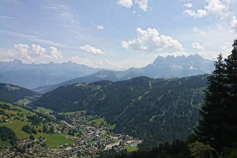
During this walk you will cross mountain pastures and forests to reach Pointe du Midi, which offers you a magnificent panoramic view of the Valley and neighbouring Switzerland. Maybe you will see chamois there.
From the Linga carpark follow the direction of Aity d'en Haut. Follow the track on your left entering a beautiful spruce forest.
At the Pertuis d'en Bas mountain pasture, the trail becomes a path and leads to the Pertuis d'en Haut mountain pasture, where you can see the chalet.
At the chalet, continue the ascent on your left until you reach the Col de Fécon, which can be perceived in the middle of the "voraches", the local name given to the wild alder.
The itinerary then becomes rougher and it is not uncommon to be able to observe deer and chamois, if you're discrete. Cross over the ridges and pass by the Plan des Mitres and the Pointe du Midi to admire the picturesque and beautiful view over the Abondance valley, Morgins and the Swiss Alps.
Once at the Pointe du Midi, turn left onto the path through the undergrowth without leaving it until you reach the place called "Les Blattes". At this level, turn left to reach the Aity d'en Haut where you find the original route.